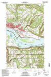


The Libre Maps project has purchased and made available for free all of the USGS Topographical maps of the USA. All 50 states.
The maps have always been free sort-of, there was just no where until now to actually GET them for free. The Libre Maps project raised enough funds to buy the many gigabytes of data and the Internet Archive is hosting them.
These are great 24k scale topographical maps folks. The same types you pay for in sporting goods stores. And many applications on your computers can work directly with them and your GPS. You can get water and tear resistant paper and print them out..
All good stuff...
For the lazy in the audience, here are Oregon's.
Comments
Now to find a 15-inch color display that doesn't get washed-out in the Arizona shade. :-o